
Make the McKenzie Connection!
Make the McKenzie Connection!
Includes interactive links Holiday Farm Fire projects
A new interactive “story map” has developed by the Willamette National Forest to showcase projects designed to reduce risks in areas impacted by the 2020 wildfires. Officials say data from the 2020 Fire Affected Road Risk Reduction Project’s “will be recorded and updated directly on the site for the public to stay informed of the latest updates. Although the 2020 fires impacted other public and private lands, this project is centered on Forest Service lands as one piece of the overall fire recovery to restore safe road access.
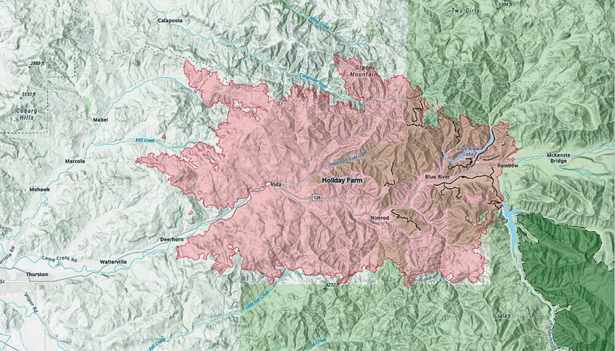
In what have become known as the “2020 Labor Day Fires,” the Holiday Farm, Beachie Creek, and Lionshead Fires burned approximately 571,435 acres of land across private, municipal, State, Tribal, and Federal lands. A historic windstorm on September 7th, 2020, caused the fires to rapidly spread west on the Willamette, Deschutes, and Mt. Hood National Forests.
This story map was created to increase understanding of the 2020 Fire Affected Road Risk Reduction Project’s purpose and implementation process on the Willamette National Forest. Although the 2020 fires impacted other public and private lands, this project is centered on Forest Service lands as one piece of the overall fire recovery to restore safe road access.
Across the Willamette National Forest, the Labor Day Fires affected 550 miles of National Forest System roads, as well as state highways that connect millions of Oregonians
living west and east of the Cascade Range. These roads provide access to private land holdings, communications sites, recreation sites, utilities, and for fire and forest management activities, including fire recovery.
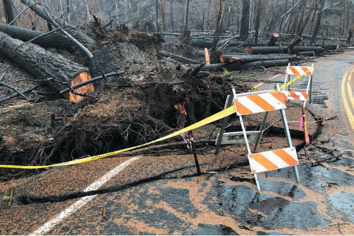
Areas of fire-killed and injured trees remain standing or have fallen across hundreds of roads across three ranger districts in the Willamette Forest. Assessments have shown fire-killed and injured trees are impeding access and present hazards to people traveling the impacted forest roads, with risks increasing over time.
For wildfire areas that have since reopened, officials say visitors should expect a changed experience. This could include roads and trails blocked by fallen trees, hard-to-navigate stands of burned trees, eroded slopes that lack signage, and missing sections of trail.
People are being cautioned to look in three key areas:
* Look up in the upland burned areas, snags, and exposed rocks that may fall,
* Look down for debris from falling rocks, erosion – especially at road and trail edges, and ash pits (which may form from root pockets or stumps of burned trees),
* Look around to be aware. Check the weather before you travel, including at higher elevations. Wind, rain, ice and snow can increase the risk of tree fall, rock fall, slides and other hazards. Flash floods and landslide risks are elevated below severely burned areas.
*And look below the surface of standing water or moving water for floating logs, submerged trees and other debris, which can strike or entangle swimmers and boaters and damage other infrastructure.
For more information about other wildfire recovery work, visit the Willamette National Forest’s website at .fs.usda.gov/willamette.


Reader Comments(0)