Snagged at Fish Rock: River Debris Prompts Caution
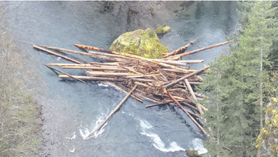
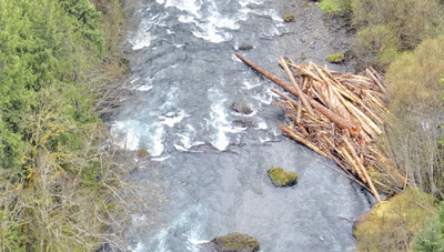
MCKENZIE BRIDGE, Ore. – Boaters and river users are being urged to use extreme caution-or avoid the area altogether-after two significant obstructions were reported on the upper McKenzie River near Highway 126E milepost 55, according to the Lane County Sheriff’s Office.
The hazards are located in the vicinity of Fish Rock, where multiple large tree trunks and smaller debris are blocking much of the river channel at two separate points. The reported coordinates for the obstructions are 44.18771, -122.06962.
Authorities say the first blockage is situated along river right on a relatively straight stretch of water and may be passable under certain conditions. The second obstruction, however, poses a greater concern. Located midstream at a fork in the river, it may or may not be safely navigable depending on water flow and debris movement.
Officials noted that some portage options may be available along river left, though conditions can vary.
The sheriff’s office advises river users to avoid this section if possible or proceed only with heightened awareness and caution.
Deputies with the Lane County Sheriff’s Marine Patrol are currently coordinating with local organizations to assess the situation and explore mitigation options.
The obstructions were reported on April 2.
Author