
Make the McKenzie Connection!
Make the McKenzie Connection!
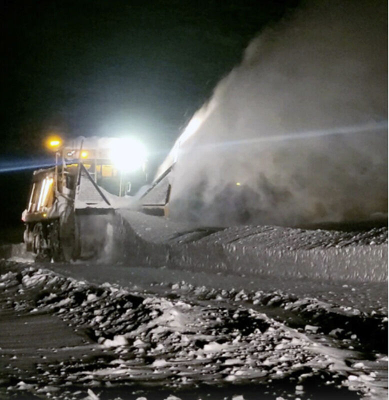
With the recent change to winter weather conditions, motorists might need a friendly reminder about what to do when they encounter a snowplow on the road.
“It’s illegal to pass a snowplow on the right on state highways,” according to Oregon Dept. of Transportation Public Information Officer Mindy McCartt. And, on most Oregon highways, snowplows have “wing” plows that stick out more than eight feet from the right front edge of the truck, she adds. People should also be aware that the snow being plowed or blown off the road can contain rocks and other debris that can damage vehicles.
“Passing on the right of a snowplow isn’t just against the law, it’s a risky gamble with lives,” McCartt says. “Our plows work hard to clear roads for everyone’s safety, but their wings and the swirling snow make visibility challenging. Patience behind a plow isn’t just courteous, it’s a commitment to keeping everyone safe on the road.”
In addition, drivers who try to pass on the right when a snowplow is in operation run the risk of damaging their vehicles, hitting the plow, or running off the road into a snowbank or guardrail.
There are more reasons why drivers should give winter maintenance vehicles like plows and sanders a wide berth. They don’t travel at high speeds which means vehicles can quickly overtake them but plows and sanding trucks pull over periodically to let traffic pass. ODOT says the best advice is to stay at least three car lengths behind and allow for more time in snowy conditions.
For the latest travel updates, visit ODOT’s mobile-friendly travel information website, TripCheck.com. The site features:
* Maps updated in real-time that display road conditions.
* Color-coded traffic speeds on most roads across the state.
* Trouble spots — whether from a traffic incident, inclement weather, construction, or maintenance.
* Alerts: These are high-impact incidents prominently displayed.
* More than 700 camera images from key locations throughout Oregon as well as western Idaho, northern Nevada, southern Washington, and northern California.
* Custom camera pages, where you can choose up to 10 different cameras for quick checks of specific routes.
* Waze user reports and incidents (overlaid on the TripCheck map).
* Information on trucking centers, safety rest areas, Sno-Parks, and more.
* “Travel Time,” showing current travel times from key highway connections.
* Links to public transportation providers, schedules, planners, and more, so you can explore car-free options.
TripCheck information is also available via X (Twitter). Visit TripCheck.com and click the On-the-Go tab to learn more. TripCheck TV allows users to create a custom display of road condition information and camera images.


Reader Comments(0)